


An entire block of Aiken soil is getting intense attention this week, with the help of some high-tech tools, amid an effort to study Pine Lawn Cemetery and get a better idea of its history and holdings.
The cemetery, at Hampton Avenue and Florence Street, reportedly dates back at least to the 1850s and poses a challenge for researchers hoping to get an accurate grave count, due to the large number of unmarked graves — thousands in all, according to various estimates. Pine Lawn covers 10.5 acres and apparently has at least 5,000 graves, according to some project boosters.
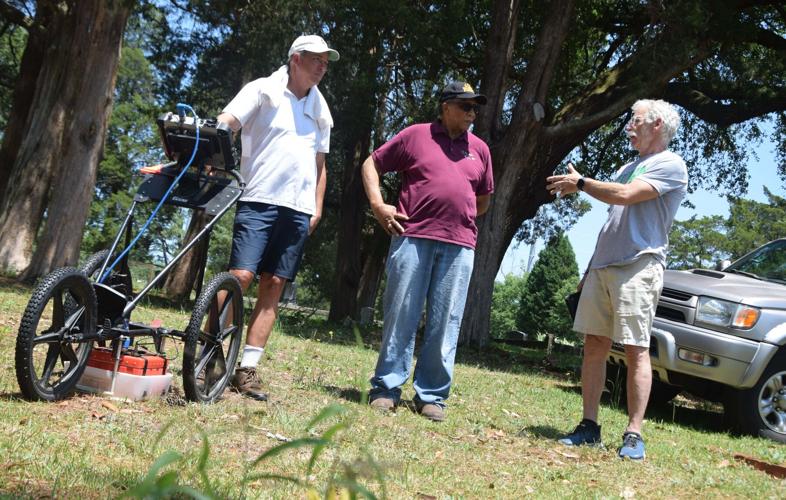
Benton Smith, owner of Sentry Mapping, based in Oxford, Mississippi, was on duty in the cemetery May 7-8, using ground-penetrating radar to determine gravesites’ locations and provide an accurate record for future generations. Some graves are clearly marked and others appear as a complete surprise.
The project is receiving a $200,000 boost from the $25 million received from the state’s settlement with the Department of Energy over plutonium stored at the Savannah River Site. About $26,500 is to go into the mapping effort.
“It’s like a dream come true, to know how many people are there and where they are,” said Coleen Reed, a member of the cemetery’s board of directors. She pointed out that Pine Lawn is “still an active cemetery,” and hopes are to avoid situations in which a burial is attempted in a plot found to be already occupied.

Army veteran Hallie Holland, also a board member, commented on a reason behind the project. “I’ve seen so many cemeteries that have been abandoned and unkempt across the country, and we have some in Europe that look like botanical gardens. They keep them so neat,” he said.
“It’s a last resting place, so it should look better than your front yard. It should be a place that is worthy of you having lived, so I think cemeteries are sacred. They should be maintained as a memorial to those people who are buried there.”
Smith offered an overview of the process. “What we do is, we… help preserve the heritage of cemeteries, so… if a cemetery’s not appropriately mapped — and most of them are not — our goal is to provide a survey-grade, as-built map of the cemetery. We’re not surveyors, but we use survey equipment to do that,” he said.

The end result, he said, is to include both a paper map and a “web map that’s clickable and searchable.” Someone looking for information in the future will be able to use a computer to get a look at the relevant headstone(s) if legible information is available. Some of Pine Lawn’s headstones are clearly marked and relatively recent, while others pose a challenge for researchers.
Information made available via a website such as findagrave.com is permanent, “so the next generation of… cemetery caretakers will just have an easier time with the cemetery that they care for,” Smith said.
Board member Andy Dyer said the situation is “starting to look not good” in terms of finding available spaces in the cemetery, especially in an area that was apparently used for slave burials. “There are so many bodies back there — just everywhere.”
Future proposals, he said, include installing plaques to help point out graves of some of the more prominent individuals, and a historical marker to help tell the entire facility’s story.

